Geospatial planning of rural electrification

GEOSIM is a decision support software leveraging GIS technology to create and simulate rural electrification planning scenarios at a territory or national scale. As a pioneer and global leader in geospatial planning, GEOSIM enables the identification of the most cost-effective solutions for electrifying areas, offering a range of economically and technically viable projects.
With a rich history of successful geospatial planning for rural electrification and extensive development across many countries, GEOSIM is widely utilized by organizations, public authorities, and institutions in Asia and Africa. Featuring four main modules, GEOSIM stands out as the most innovative and powerful software, harnessing GIS technology to advance rural electrification planning.
- User-Friendly Interface: Allows users to test electrification scenarios, including grid extensions and decentralized projects using renewable energies.
- Comprehensive Reporting: Provides multiple socio-economic reports and cartographic outputs for each scenario.
- Advanced Scenario Customization: Offers detailed customization of rural electrification scenarios, making it accessible to all users.
- Diverse Renewable Energy Options: Explores various renewable energy sources during planning, providing maximum flexibility for designing cost-effective projects while considering on-the-ground and socio-economic factors.
GEOSIM is a dedicated decision support tool for geospatial planning of rural electrification, aimed at decision-makers and planners. It leverages GIS databases to develop low-cost electrification plans, including simulations for network extensions and decentralized projects such as hydro, biomass, solar, and wind.
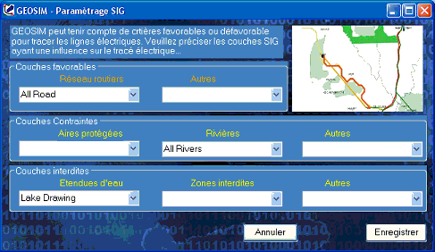
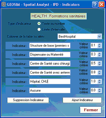
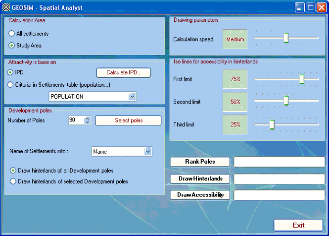
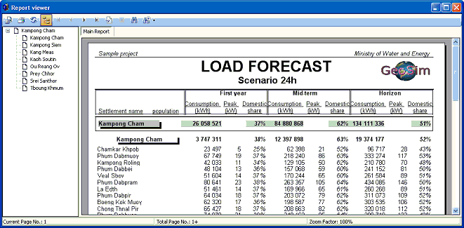
Screenshots